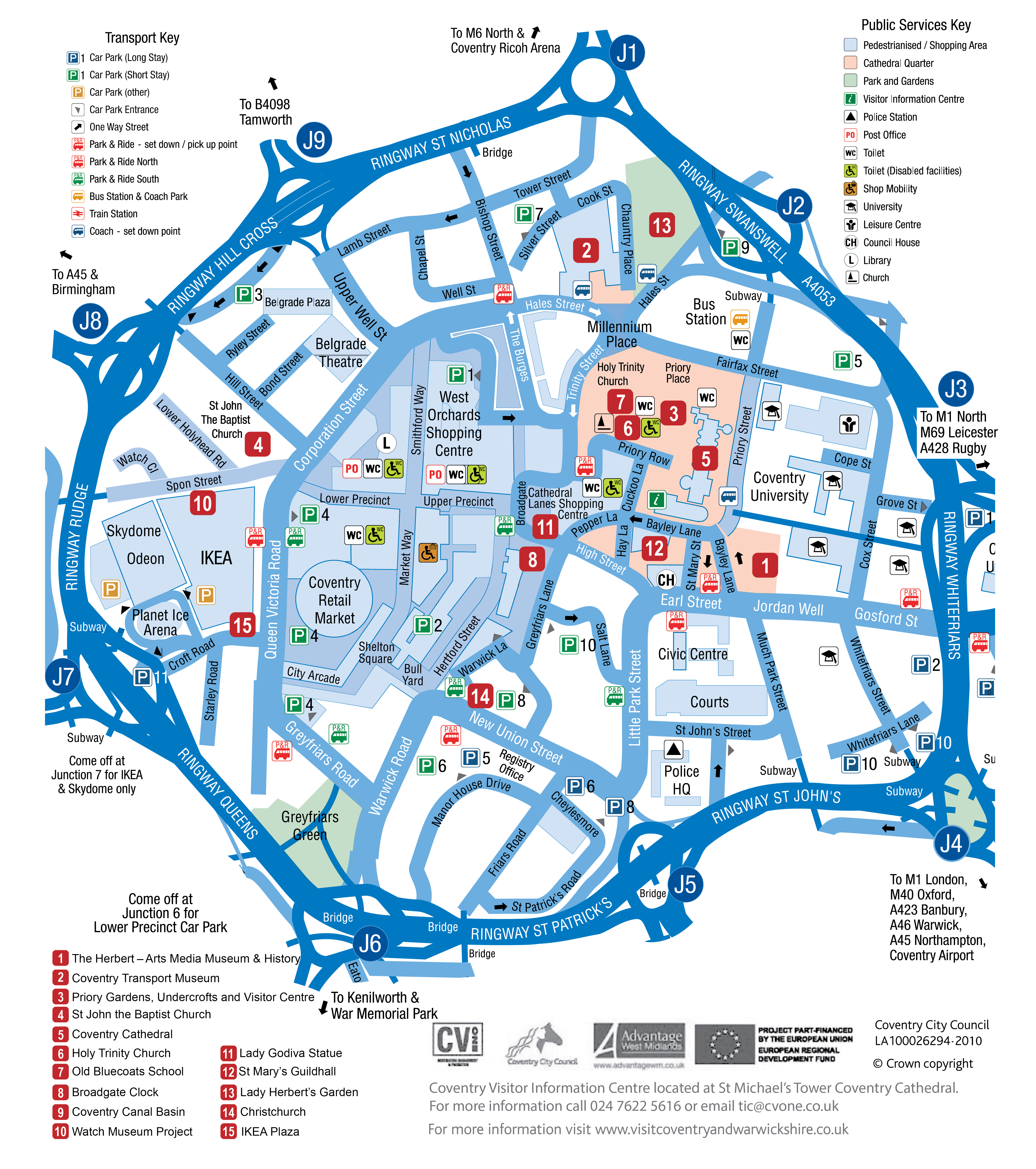
This entire map was re-drawn from a black and white photocopy, so that the roads and labels could be made colour and easier to read. The only original elements remaining are the logos and text in the bottom right hand corner.
This was used for a Leisure and Tourism examination paper.